
Lifeless, motionless, and odorless, the land above the tree line is a stark landscape of clear skies, intense sun, and thin air. To acclimatize for our upcoming Mt. Whitney attempt, we entered this barren and breathtaking world on three training hikes of increasing altitude and elevation gain. The contrasting hikes included a steep ascent of a mammoth volcano, a climb along the spine of the Sierra Crest, and a long trek to the top of an exposed high desert mountain.

Joe hiking up the Dragon’s Back Trail
On our initial crossing of the tree line, we slayed the scary-sounding Dragon’s Back Trail to the 11,053-foot (3,370 m) volcanic summit of Mammoth Mountain. On the steep relentless trail, we met an older gentleman who had hiked Mt. Whitney more than 40 times. Over a cup of hot tea in the summit lodge, he shared his experiences with us, and encouraged us toward our higher goal.

Mammoth Mountain Scenic Gondola (the easy way down)
Upon reaching the summit of Mammoth Mountain, we were informed that we could ride the scenic gondola back down the mountain for free. Never ones to pass up an easy way out, we hopped into the small metal capsule, and suspended by a thread we descended back below the tree line.

Es crossing Mono Pass
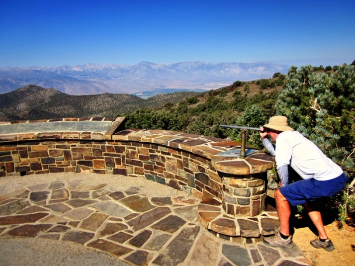
On our second training hike, we reached altitude by first driving up a paved road to Mosquito Flat at an elevation of 10,272 feet (3,131 m), the highest designated trailhead in the Sierra Nevada mountain range. From there, we ascended the decomposed granite trail to the saddle of Mono Pass at an elevation of 12,077 feet (3,681 m).

Ruby Lake and the Sierra Crest from the Mono Pass Trail
The 8-mile (13-km) roundtrip hike passed through the John Muir Wilderness, and into a landscape of whitish vertical rock faces against concentrated blue skies. The panoramic vistas from the trail included the toothy Mt. Abbot mountain group, the serrated Sierra Crest, and an overview of brilliant Ruby Lake and the entire Little Lakes Valley.

The White Mountain Peak Trail
For our final acclimatizing hike, we upped our game by making it to the top of White Mountain Peak, the third highest point in California at 14,252 feet (4,344 m). We began at a locked gate at 11,670 feet (3,557 m), walked along a four-wheel drive road past the University of California White Mountain Research Station, and followed the rocky trail all the way to the summit.

Our first 14er!
Light-headed, short of breath, and with tingling fingers, we stood on the top of the exposed desert mountain peak, and looked across the Owens Valley at Mt. Whitney itself, just 253 feet (77 m) above our heads. With new-found confidence after climbing our first 14er, we have now clearly set our sights on our ultimate goal of reaching the highest point in the contiguous United States.

Bristlecone Pines of the White Mountains
Returning to the timberline of the White Mountains, we were greeted by a forest of stunted and gnarly Bristlecone Pines (Pinus longaeva), the oldest living non-clonal organisms on Earth. Alive for over 5,000 years, these ancient trees flourish and succeed at this extreme elevation in the hard dolomitic rock, devoid of water, shade, and competition.
Our sight is set on Mt. Whitney
For us to flourish and succeed at high altitude, we went on three hikes to the timberline and beyond. Crossing into this lifeless landscape, under clear cloudless skies and the intense shadowless sun, we marched on as high as we could go. This Monday, we will attempt to go one step higher, to the summit of Mt. Whitney, and the crown of the Lower 48.

Lizzie being fed Cheetos by our three year old niece at Granny’s house. We don’t think she is missing us.

I’m so impressed! I think I’d like to try that climb, but I’d probably pick the spring or the fall so it’s a bit cooler. Looking forward to reading about your successful climb! (I’m sure that Lizzie misses you but… Cheetos.)
LikeLiked by 1 person
Thank you, Janis. Hope your hip is recovering swiftly. Besides the thinner air above the tree line, the temperatures are much cooler too. August and September seem to be the peak months to hike around here, after the snow melts and before it starts falling again. I’m not sure if Lizzie will want to leave Granny’s house when we come back to pick her up to go to Monterey at the end of the month.
LikeLike
Once again, I am envious and in awe of your experiences. So few people get the chance to do what you’re doing (or, to be fair, I should say so few people even give it a try) but I’m happy that you are sharing these things with us. (I am especially fascinated with the Bristlecone Pines, for some reason.) But at the end of the day, I have to ask: What is up with that HUGE water bowl for Lizzie? Do the Cheetos dry her out a bit? 😉
LikeLiked by 1 person
Hey Brian, You are the master of detail. My mom (Granny) has a very thirsty and rambunctious black lab that is keeping Lizzie company while we are away this month. We are extremely lucky to have the time and health to do the things we are interested in. After working for 30 years and bringing up two children, it is finally our time. I understand and share your fascination with the Bristlecones. At 5,000 years old, they must have some wild stories to tell.
LikeLiked by 1 person
Well done! What a great achievement 🙂
LikeLiked by 1 person
Thank you, Sarah! I like hiking because it doesn’t require a lot of skill. Just some comfortable footwear, a healthy pair of legs and lungs, and a well-marked path so I don’t get lost.
LikeLiked by 1 person